Goodnow Flow flooding events
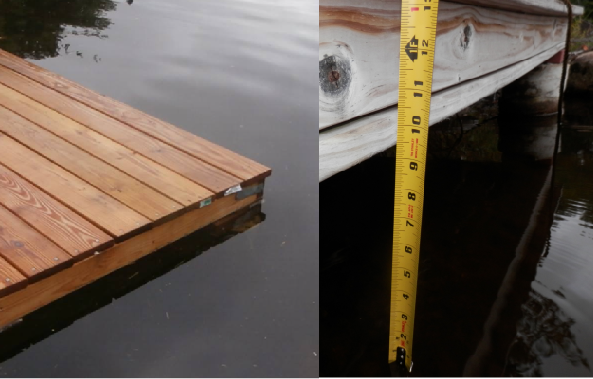
The Flow has overfilled several times since the 2016 dam and spillway rebuild began. This may have been inexperience managing the gates or due to real limitations in the capacity of the openings to clear water. It doesn’t affect me much given that the bottom of my cabin piers are grounded about 4ft above lake level and the cabin is at least 3ft higher, the biggest effect is that my wooden docklet used to start floating off the supports (now I store 200lb of bagged drainage gravel on the deck) and a waterside path get partly submerged. However – there are other Lots were flooding is more of an issue for folks property. Normal summer levels are around 10″ to a foot below what I’ve seen in flooding. Water levels are dropped another ~3 ft in winter to provide surge capacity.
Goodnow Flow water level surveillance – Flood watch
I’m trying to set up an easy gauge of water levels. You can see some fluorescent markers in the picture of ‘my’ stream to the right of the wooden boards walkway. The fluorescent bands are 6” and the first should be submerged if the water level is up 6” from current summer levels, then the second will be submerged by a foot elevation. The tags only show up clearly at night. Mind – if the water is up 10” or so, then the whole of the bank in the foreground of the camera shot will likely be flooding. Note that my dock is getting ready to float or submerge when the water is coming up to and over the stream bank,
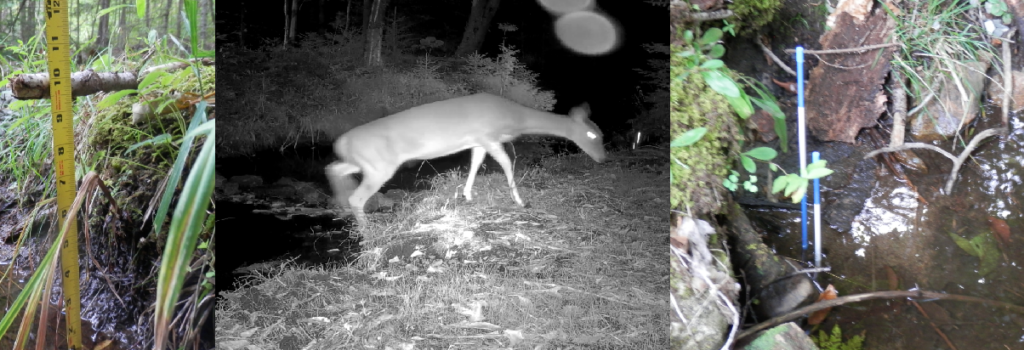
You should be able to see images at the Wunderground weather Cam page. Use this link or go to the website weather page. You can see the current shot and run a ‘video’ of complied pics from the past day or so.
Give me feedback on what water levels mean to you
I really need feedback for the website on when flooding happens for you and how my levels looked in the images (when it happens). Use the contact form in the website and/or send me a message in Facebook (see the Goodnow weekly/ GoodNOW! Page).

There is a ‘chokepoint’ set by rocky outcroppings that defines where the stream meets the lake. Its possible that the levels on the two sides will transiently get out of balance but I figure it will only be for a few hours, even under extreme conditions.